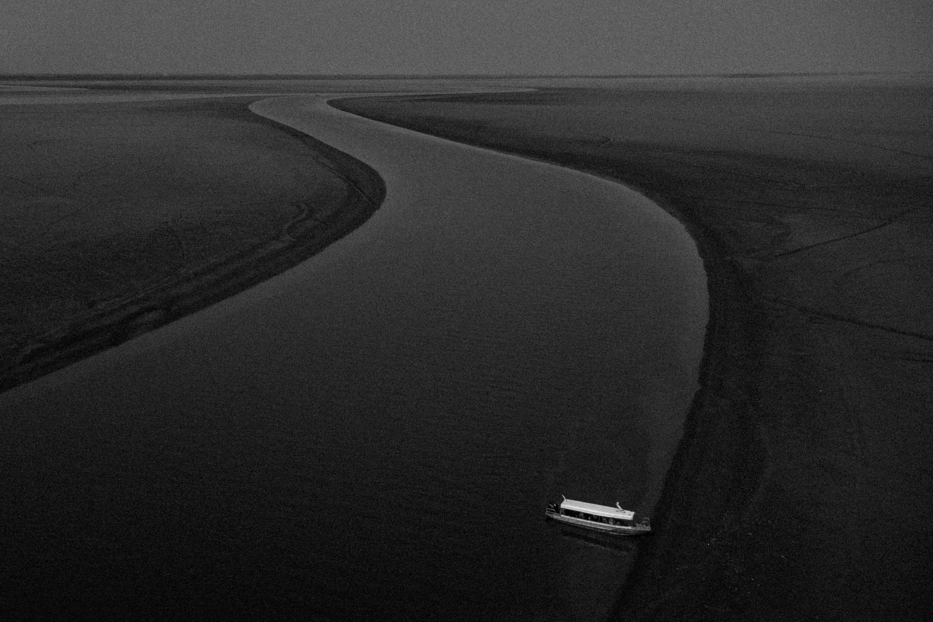
A boat sits in the shallow waters of Lago Grande, one of the areas most affected by the extreme drought in the Amazon Basin. This image was taken in Manacapuru, Amazonas, Brazil. The 2023 drought was the worst ever recorded in the state of Amazonas. The drought affected all of the state’s municipalities in terms of services, transportation, and supply because rivers are the main route in Brazil’s largest state. All of the state’s cities were built around the rivers of the Amazon basin.
![]()
Quando as águas/When the Waters
Words & Images Raphael Alves Translation C. Cornell Evers
Quando as águas/When the Waters is a photographic project that seeks to explore the relationship between man and the water cycle in the Amazon. These issues are addressed in the context of the eternal dichotomy of ebb (vazante) and flow (enchente) that sustains the continuity of life in the water and to which the Amazonian people have historically had to adapt.
In addition, Quando as águas/When the Waters proposes a debate on the evident effects of climate change around the world, which have a direct impact on events related to the water cycle in this region: episodes of extreme flooding and devastating droughts are becoming more frequent.
As a parameter to assess the intensity with which the phenomena are occurring, it is enough to point out that the record of the water level of the Rio Negro during a flood period was broken for the first time after 56 years, since the river began to be ‘measured’ (in 1902): it reached 29.69 meters in 1953 and 29.71 in 2009. That year, the rising waters caused many problems, especially in Manaus (the largest city in the Amazon), such as the flooding of riverside communities; the diversion of traffic, as several streets were flooded; commercial losses, as shops were submerged; and the spread of disease, as the flooding period caused the sewage system in the central region of the city to overflow.
Many people thought that such an extreme event would not happen again for another half century. They were wrong. In 2012, the level of the Negro reached 29.97 meters, and all the problems of the 2009 flood came back stronger as Manaus grew more and more.
In 2013, the flood reached 29.33 meters. Although it didn’t break the records of 2012 and 2009, the 2013 flood is one of the most intense ever recorded. In 2021, the Negro reached a new record: 30.02m. It was the biggest flood the Amazon basin has ever seen.
Droughts are also becoming more frequent. On the Negro River, the first record drought in 1964 (when the water level dropped to 13.64 meters) was surpassed only in 2010 (by one centimeter, when the water level dropped to 13.63 meters). The worst was yet to come. In 2023, two years after a major flood, the Amazon Basin experienced the largest and most severe drought in its history. All 62 municipalities in Amazonas went into a state of emergency. The Quando as águas/When the Waters project has witnessed these limits being pushed further and further to the extreme.
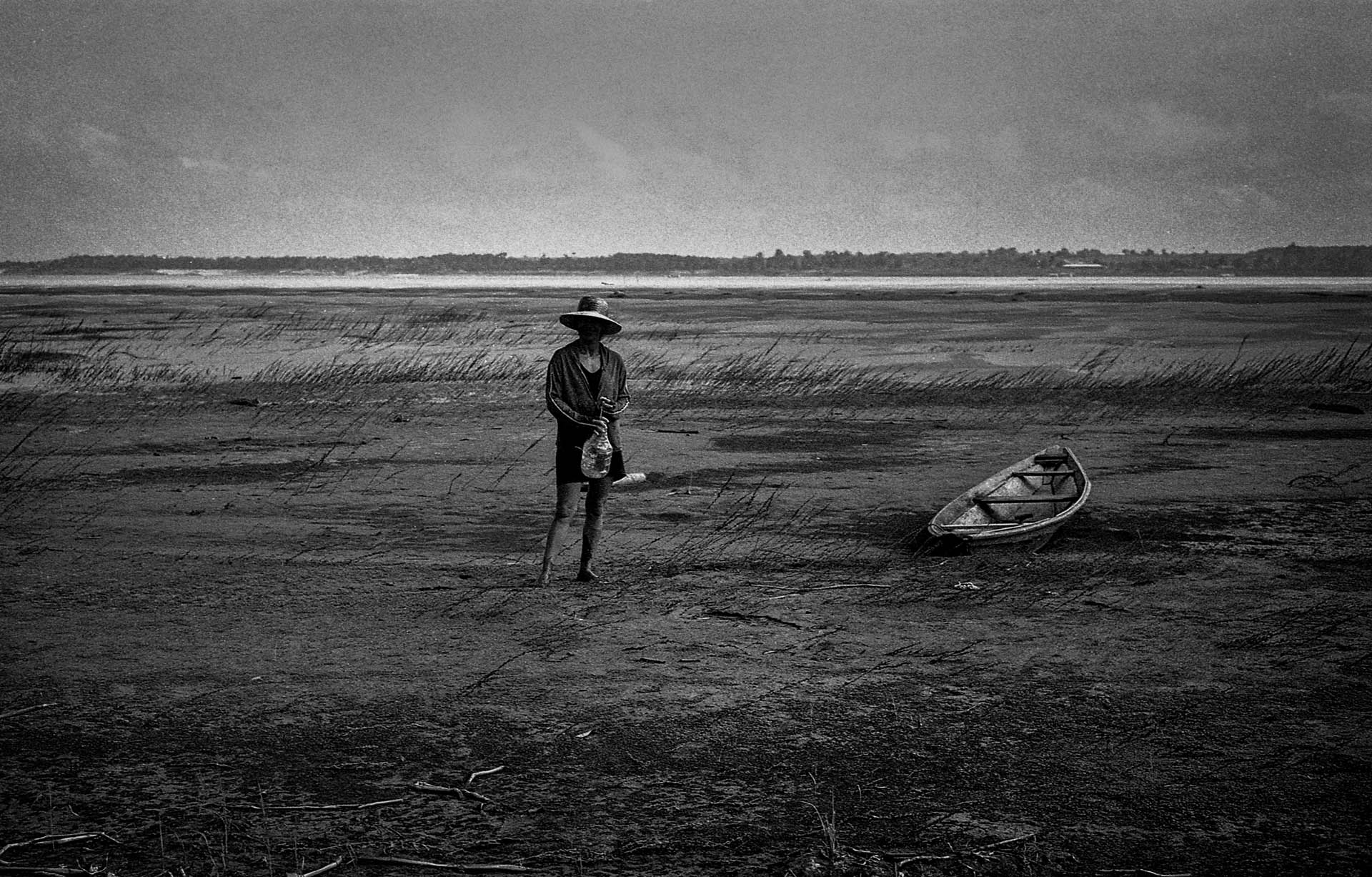 A woman carries a bottle to fetch water from the Solimões riverbed (in the rural village of Pesqueiro II, in Manacapuru, Amazonas, Brazil), which was affected by the 2012 drought. Residents of riverine areas like this one are forced to walk dozens of kilometers with bottles or buckets in search of water during periods of severe drought.
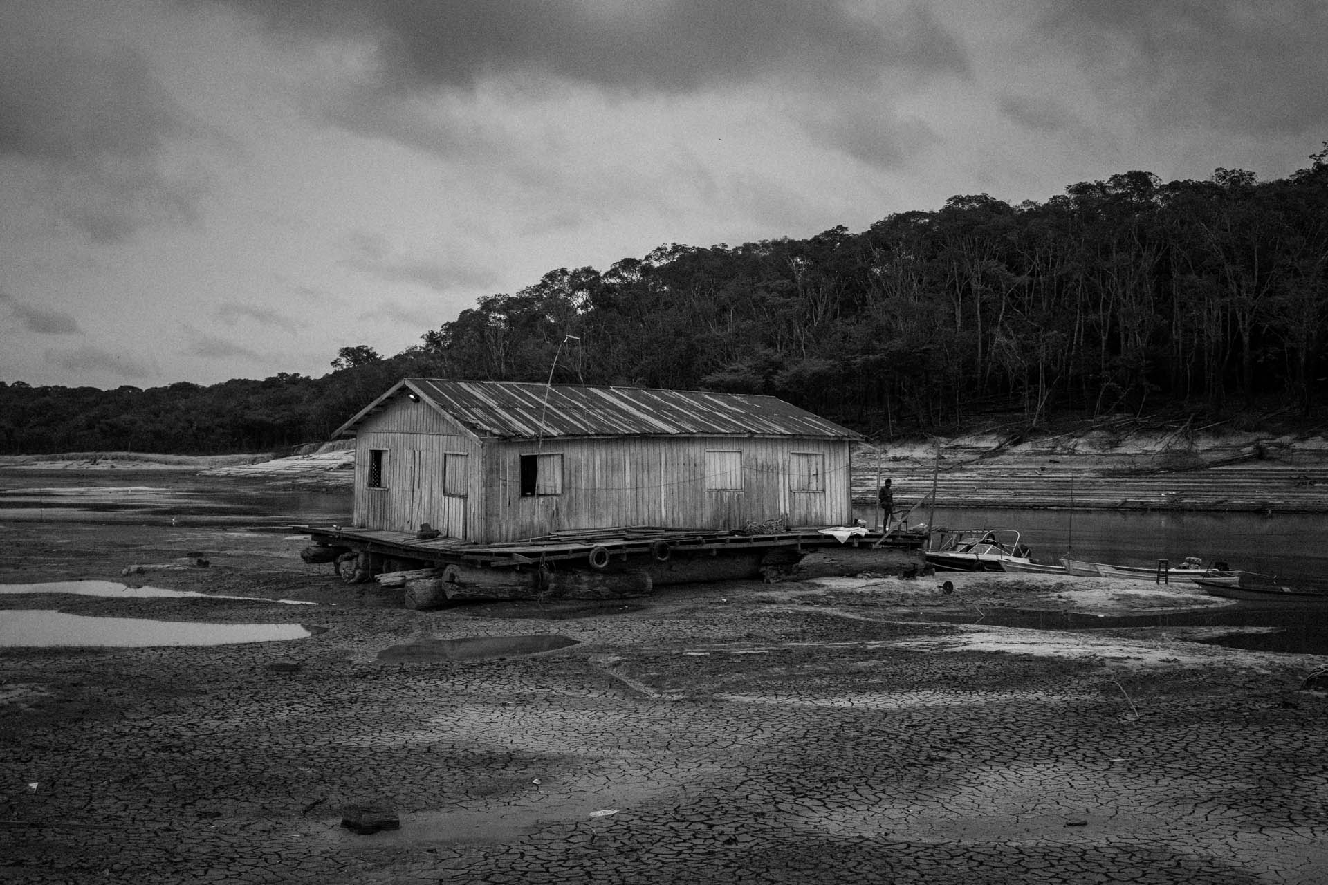 A floating house is seen stranded on the Tarumã Açu River, one of the main tributaries of the Rio Negro, in Manaus, Amazonas, Brazil. The Rio Negro, the largest tributary on the lower reaches of the Amazon River, reached 13.59 m on this day (October 16, 2023), marking the most severe drought in the Rio Negro’s history. The Amazon experienced the worst drought in its history, isolating communities, disrupting navigation, and dramatically reducing the distribution of products.
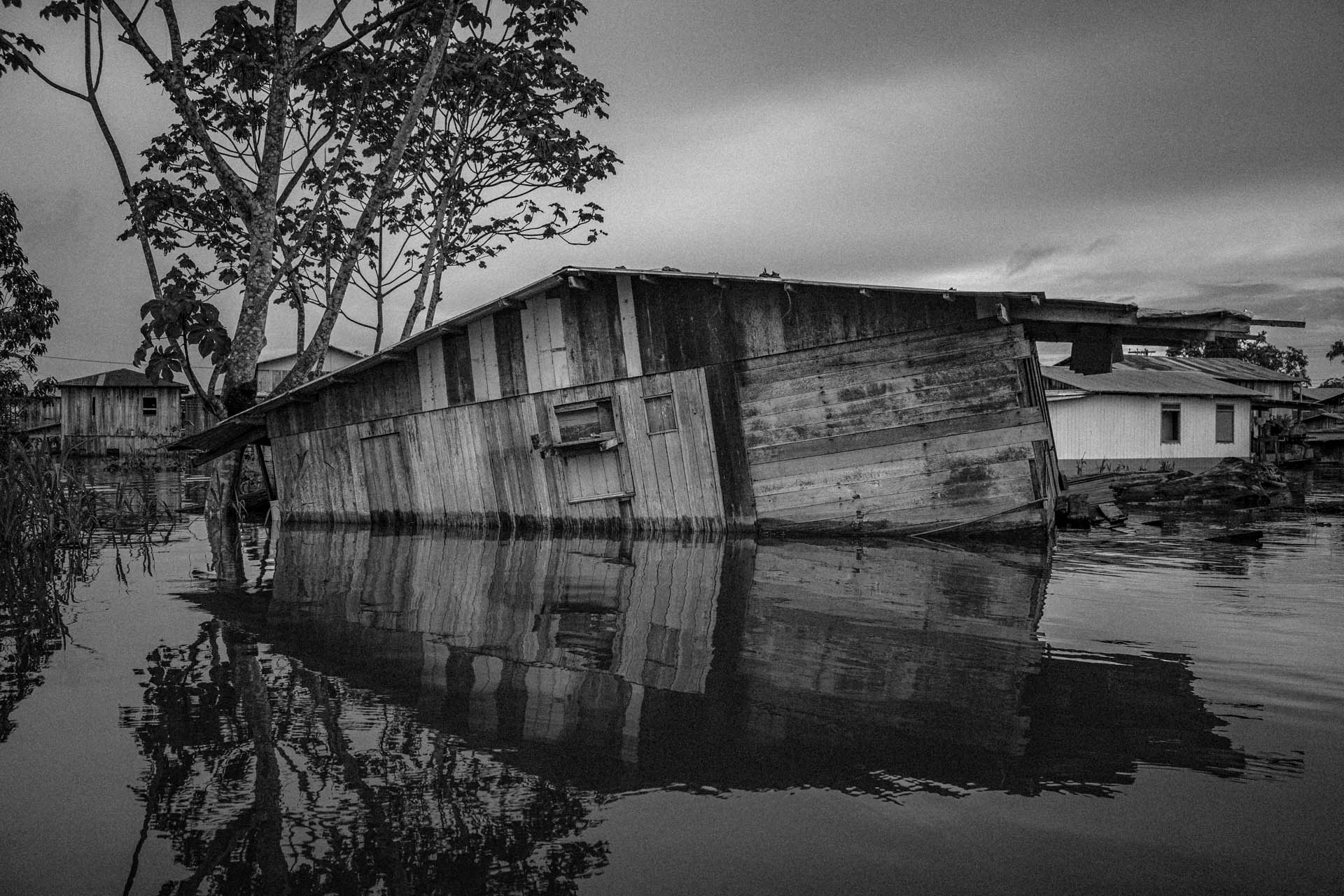 A collapsed and abandoned house is seen in the flooded streets of Anamã, Amazonas, Brazil, on May 25, 2021, during the largest flood ever recorded in the Amazon basin. Anamã has been an “amphibious city” for years. Many families are forced to leave their homes for at least three months, some forever.
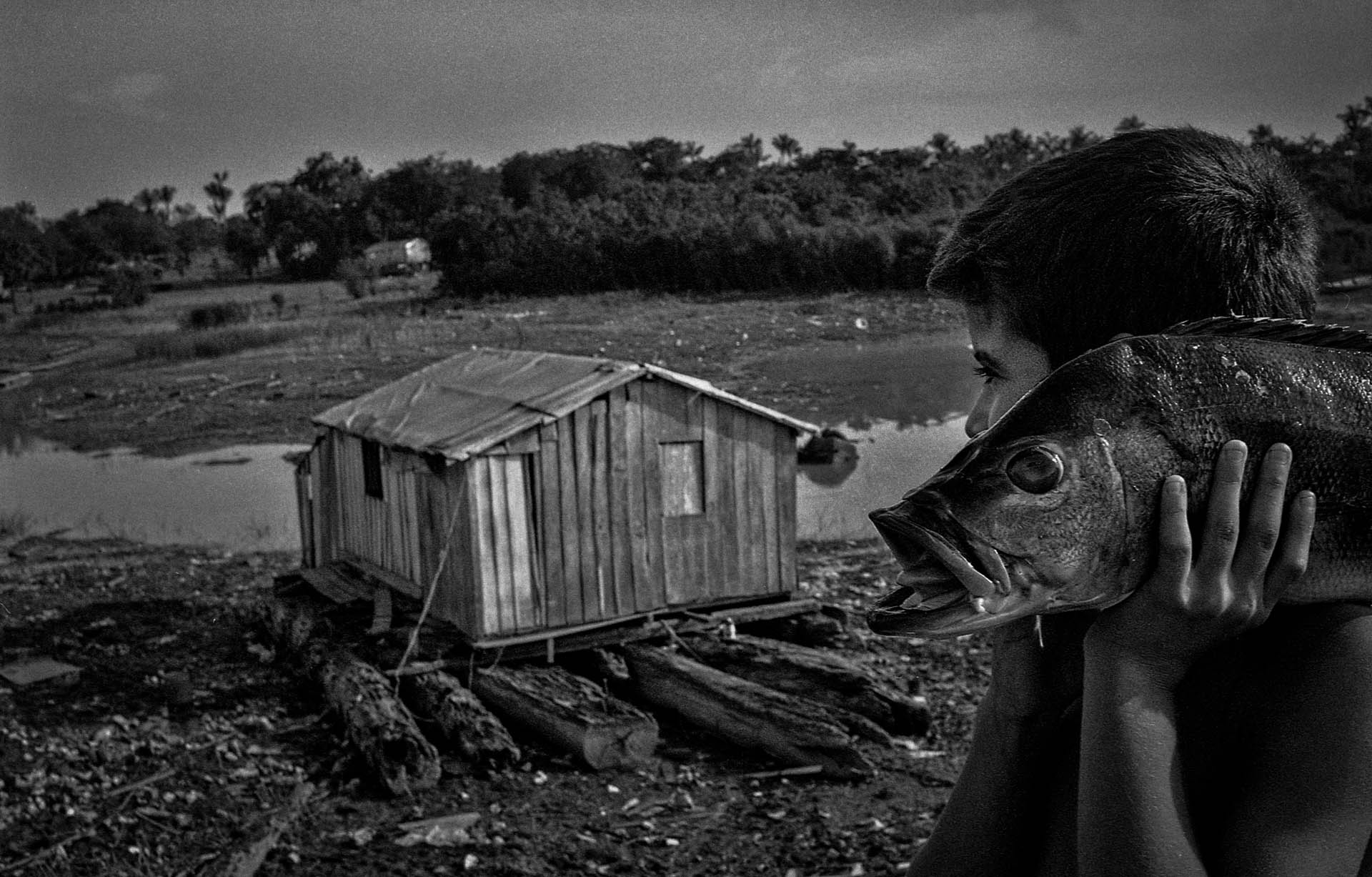 A boy carries a tucunaré he won at a fair to his floating house (located in the village of Cacau Pirêra, on the banks of the Rio Negro, Amazonas, Brazil), which was cut off due to drought in 2012. Families living along the river usually fish for their own consumption, but the dry season forces them to look for alternatives.
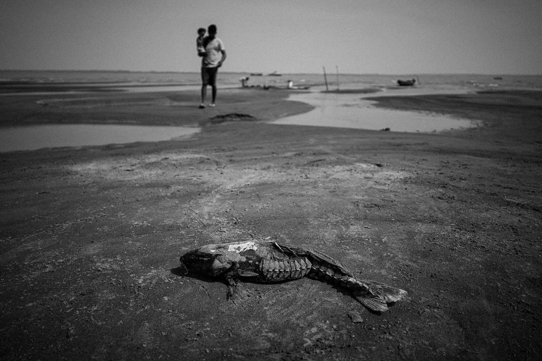
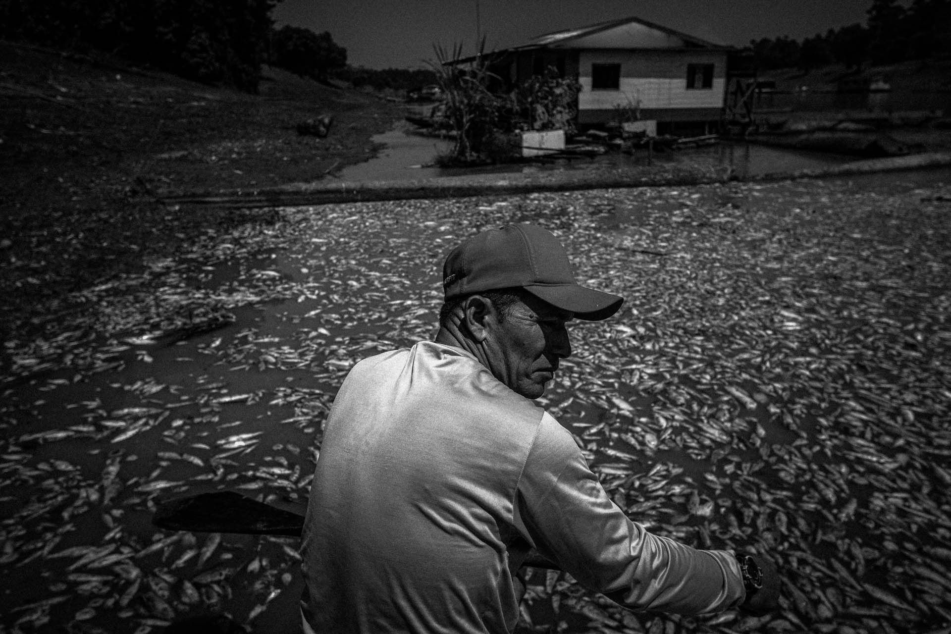 Boatman Paulo Monteiro da Cruz, 49, navigates among tens of thousands of fish killed by the heat and acidity of the water in the Lago do Piranha Sustainable Development Reserve, in Manacapuru, Amazonas, Brazil, in September 2023. The 62 municipalities of the state of Amazonas were affected by the worst drought in the history of the Amazon basin. Over 600,000 people were affected. This was the most intense drought in the history of the state of Amazonas.
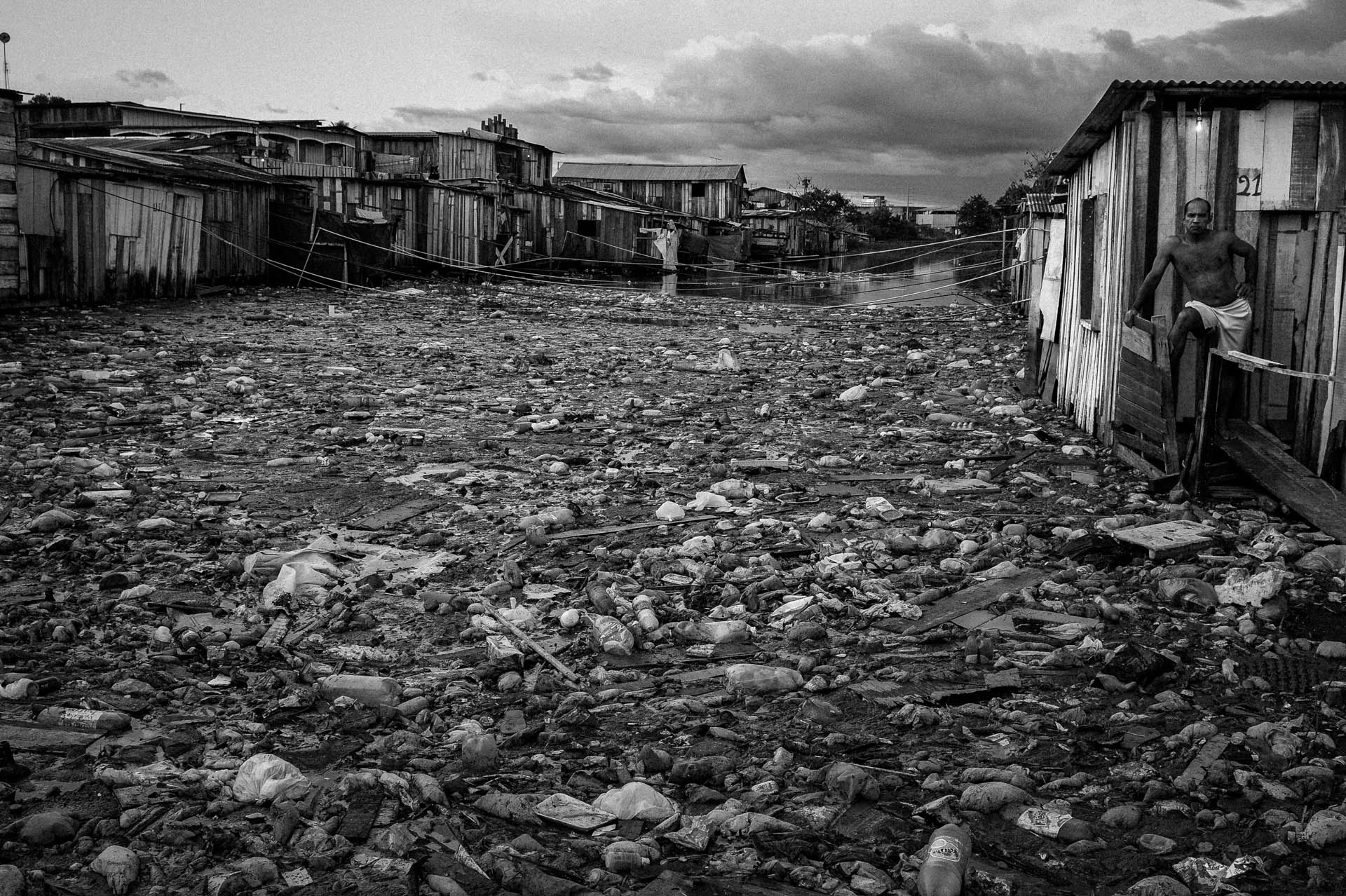 People living near the Igarapé 40, one of Manaus’ main waterways, lived with large amounts of garbage, sewage, and vermin during the heavy flooding of 2009, one of the largest floods ever recorded on the Rio Negro. Manaus’ urban rivers are unsuitable for any use due to the inefficient sewage system in the capital of Brazil’s largest state.
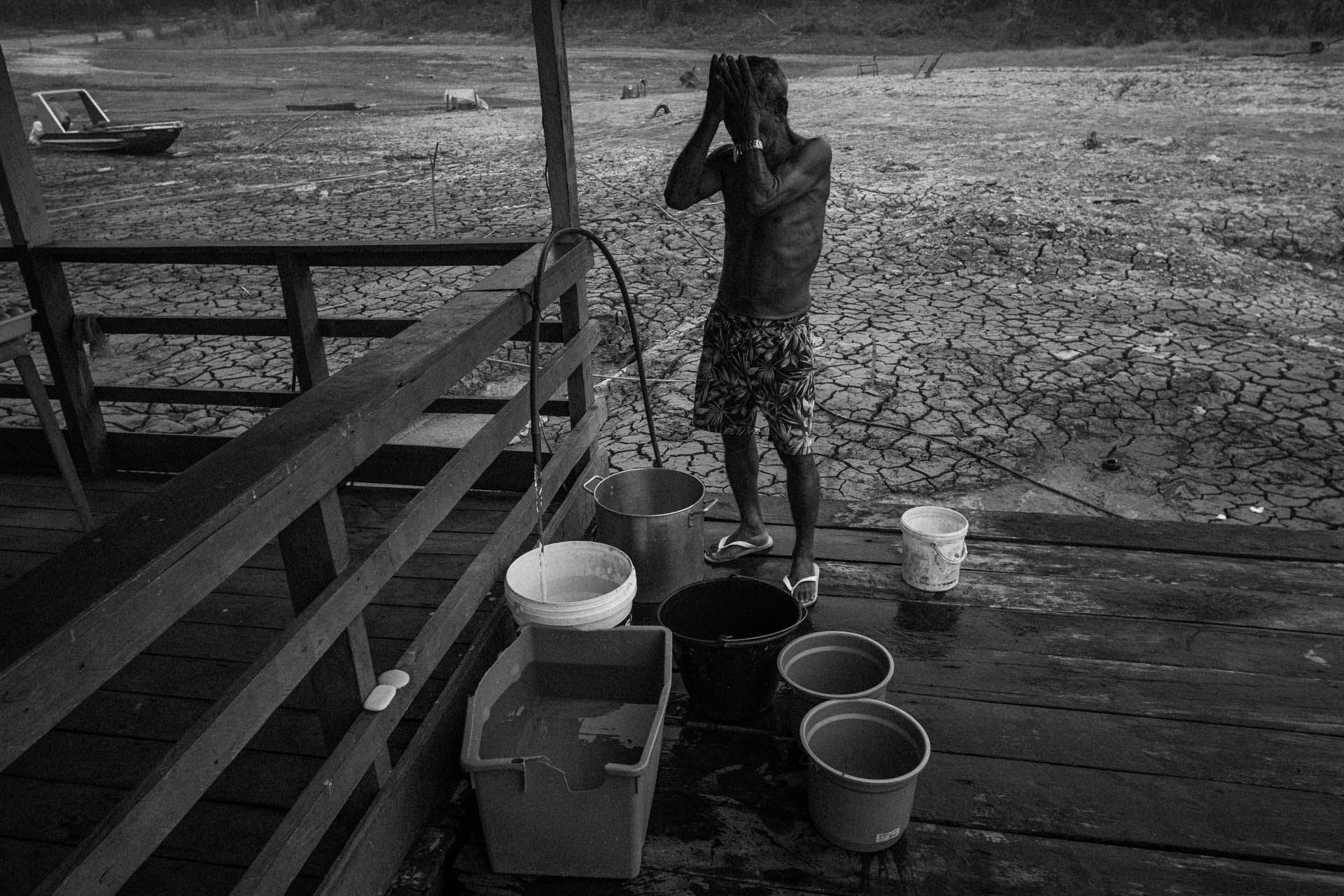 Raimundo Silva do Carmo, 68, gets emotional after collecting water from a well he dug in Lago do Puraquequara, east of Manaus, one of the places in the city most affected by the drought that hit the Amazon in 2023. Raimundo shared his well with other families in the area during this difficult time. The 2023 drought, the longest and most intense drought ever recorded in the Amazon Basin, affected access to water, products and services, and income for many Amazonian families.
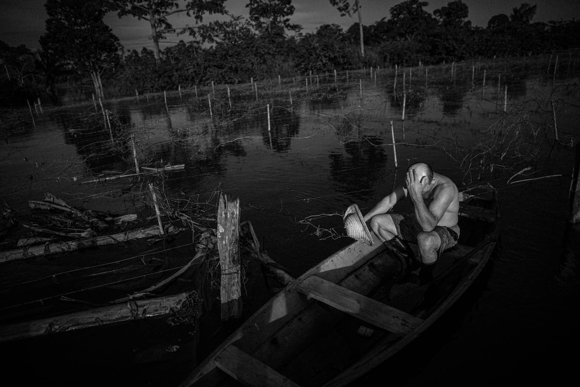 Farmer Noé Vieira do Carmo, 44, laments the loss of his passion fruit plantation due to the flooding of the Amazon rivers that affected the community of Vila do Cuinha in Anamã, Amazonas, Brazil in May 2021. Anamã has been an “amphibious city” for years. To escape the floods, residents and merchants were forced to build “marombas,” as the wooden floors of “palafitas” houses are known in Brazil. Many families had to leave their homes, drinking water arrived cloudy and smelly, and products became scarce.
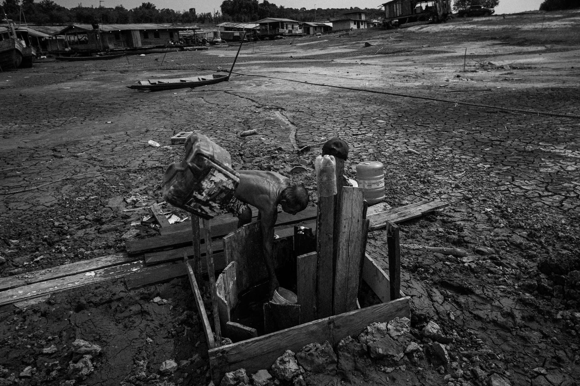 Raimundo Silva do Carmo, 68, takes a bucket from a well he dug in the mud to fetch water in Lago do Puraquequara, east of Manaus, one of the places in the Amazonian capital hardest hit by the drought of 2023. This was the most severe drought ever recorded in the Amazon basin, making access to basic things like water difficult.
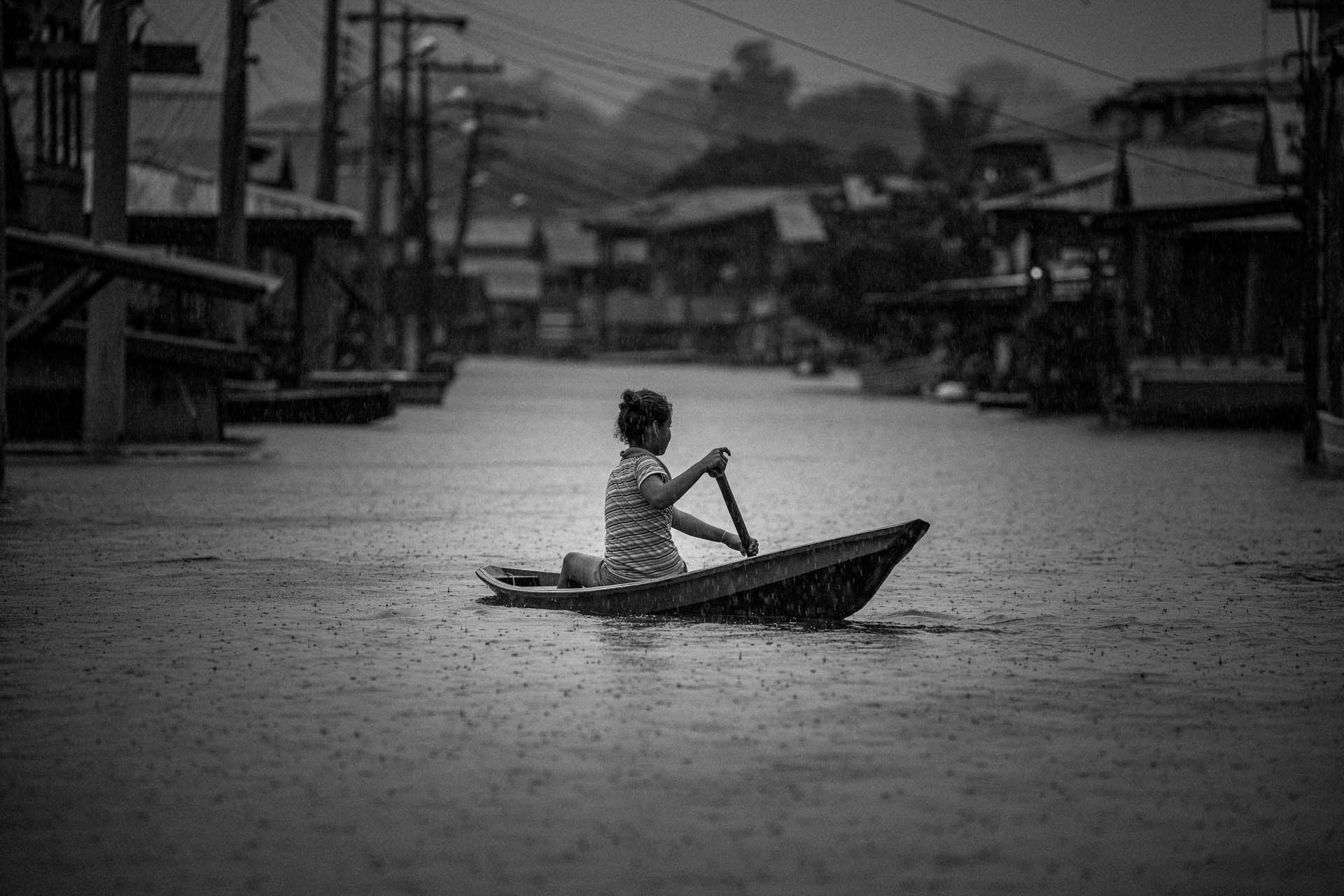 A girl steers a small canoe through flooded streets in Anamã, Amazonas, Brazil, May 25, 2021. Anamã has been an “amphibious city” for years. To escape flooding, residents and shopkeepers were forced to build “marombas,” the wooden planks known in Brazil as floors, on top of “palafitas” houses. Unlike other cities in the state of Amazonas (the largest in Brazil and home to the largest area of the Amazon) that have been affected by the flooding of the Amazon rivers, the people of Anamã (Brazil) don’t have to build bridges for transportation. Located at the confluence of the Purus and Solimões rivers, the city’s more than 13,000 residents prefer canoes as their primary means of transportation. Anamã was completely submerged during the 2021 flood, the largest ever recorded in the Amazon basin.
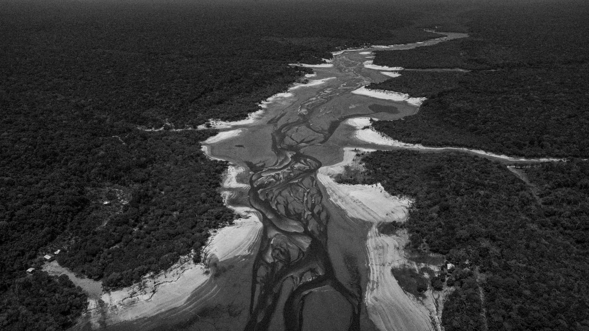 Aerial view of what remains of the river in the community of Tumbira, in the Rio Negro Sustainable Development Reserve (Amazonas, Brazil). Access to the community through the mouth of the Rio Negro would normally take only five minutes by boat. At high tide, only small boats could make the trip, which required a long walk between beaches and mudflats along a dangerous route full of obstacles. The community’s 150 or so residents have suffered the consequences of the severe drought, with difficulties getting around and finding food and water due to the 2023 drought, the longest on record in the region.
![]()
Note: The text and captions of the photographs in Quando as águas/When the Waters refer, among other things, to the water levels of the Rio Negro. It should be noted that the Rio Negro does not have a fixed ‘normal’ water level, as it fluctuates daily, monthly and annually depending on the amount of rainfall. To determine the water level, the average rainfall for each period is taken into account. A water level above 27.50 meters indicates flooding, while a level above 29.00 meters indicates severe flooding. Conversely, a level below 16.75 meters indicates severe drought.
You can find the water levels of each year here: Nível do Rio Negro > Níveis Máximo e Mínimo
And also the daily levels by clicking on ‘Nível do Rio’ on the left.
![]()
Raphael Alves’ series Quando as águas/When the Waters is his entry for the Portfólio category of the 2024 FOTODOC PORTFOLIO AWARD, a platform for publishing the work of Brazilian and foreign photographers, with annual prizes.
Organized by FotoDoc – Festival of Documentary Photography, the aim of the competition is to give visibility to the most diverse forms of photographic expression, without restriction of theme or approach, always seeking excellence in form and content.
Born in Manaus (Amazonas, Brazil), Raphael Alves studied Social Communication with a major in Journalism at the Federal University of Amazonas (UFAM), Photography at the State University of Londrina (UEL) and Visual Arts at the National Commercial Education Service (SENAC). He also holds a Master of Arts degree in Photojournalism and Documentary Photography from the London College of Communication / University of the Arts, in London (ING). Raphael’s work has won Pictures of the Year Latin America – POYLatam (2017 and 2021) and Pictures of the Year International POYi (2022), as well as the Getty Images Editorial Grant (2021). In 2023, his work won The Nature Conservancy Contest.
![]()
